

 Please log in to see the coordinates.

 Rated as: n/a


 Cache attributes


 Description
EN
Description
EN
On 9th April 2018 BradLad and I walked Yorkshire's Three Peaks circuit:
- Pen-y-ghent 694m N54 09.362 W002 14.925
- Whernside 736m N54 13.667 W002 24.156
- Ingleborough 723m N54 09.972 W002 23.870
The Three Peaks Challenge is to complete the 38.6 km (24 miles), with 1585m (5200 ft) of ascent, in under 12 hours. https://www.yorkshiredales.org.uk/things-to-do/get-outdoors/yorkshire-three-peaks/ Every year there is a Three Peaks race. If you fancy trying to beat it, the record is 2 hours 46 mins 03 seconds!
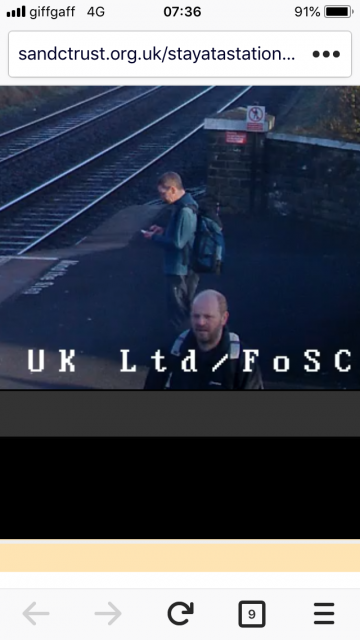
As the photos on this page demonstrate, we completed the walk in 10 1/4 hours, although we walked a few extra miles and found 13 caches on the way, including a FTF on a 9-year-old Opencache: https://opencache.uk/viewcache.php?wp=OK002F
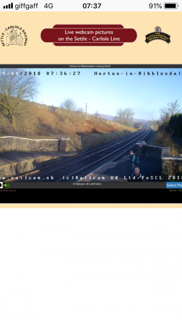
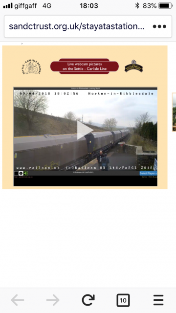
Your challenge is to take two webcam photos at the posted coordinates at Horton-in-Ribblesdale station: https://settlecarlisletrust.org.uk/webcams/ The Ofcom site claims that this location has full mobile coverage.
To complete the cache as intended, your photos need to be less than 12 hours apart and between them you should have completed the Three Peaks walk. Feel free to post photographic evidence of your full walk.
This does restrict you to starting and finishing here but the anticlockwise route, starting with Pen-y-Ghent is a good one in terms of ascent and descent steepness.
Obviously, you could cheat and if you can be bothered to come back eight hours later, having sat in the pub, then good luck to you.
In fact, there is another webcam on the Settle-Carlisle rail line that is on the three peaks walk. You can take a snapshot of yourself 1/3 of the way round at the Ribblehead station on the Ribblehead Viaduct cam on the same website: https://settlecarlisletrust.org.uk/webcams/ To be pictured on this webcam, you can make a 100m diversion from the Three Peaks route to N54 12.440 W002 21.763 or you can get a bit closer to the camera at N54 12.379 W002 21.726. The issue with this location is that the Ofcom site suggests that there is EE and Vodophone 4G coverage here, but nothing else. Maybe you can stop for a drink at the pub and ask to phone a friend to get a screengrab.
BradLad and I will leave it to you to research the route. Also, do not underestimate the challenge, which you attempt at your own risk. At some times of year you will find the route very busy indeed and the footpaths are well marked, but the weather can change quickly and you should equip yourself with suitable clothing and equipment for getting stuck at night on the hills, especially if you attempt it outside of summer months.
 Additional waypoints
| Symbol | Type | Coordinates | Description |
|---|---|---|---|

|
Interesting place | --- | You can just be seen here by the Ribblehead Viaduct cam at Ribblehead station, to the southeast. https://settlecarlisletrust.org.uk/webcams/ |
|
|
Interesting place | --- | A spot close to the Ribblehead Viaduct cam at Ribblehead station. https://settlecarlisletrust.org.uk/webcams/ |
|
|
Interesting place | --- | Pen-y-Ghent's summit |
|
|
Interesting place | --- | Whernside's summit |
|
|
Interesting place | --- | Ingleborough's summit |
 Pictures


 Log entries:
 1x
1x
 0x
0x
 0x
0x


