

 Zaloguj się, by zobaczyć współrzędne.
 0x znaleziona
  0x nieznaleziona
  1 komentarze
  1 obserwatorów
  Oceniona jako: b.d.


aby zobaczyć współrzędne oraz
mapę lokalizacji skrzynki
 Atrybuty skrzynki


 Opis
EN
Opis
EN

In June 1794, Captain William Mudge (1762 – 1820) (Royal Artillery) took charge of the ordnance survey's baseline measurement. His survey team buried a cannon, barrel up, at the posted coordinates http://trigpointing.uk/trig/7570 .
They then measured the precise distance, 36574 feet, to Beacon Hill, east of Amesbury, where they had buried another cannon. The measurements were made with 100-foot steel chains, taking into account the thermal expansion of the chains and the Earth's curvature.
Once the baseline was measured, Mudge took bearings from each end to Four Mile Stone on the Devizes Road and, knowing the length of the base, could triangulate and find the position of that location. From there, the ordnance survey could repeat this process and gradually map the entire United Kingdom. Mudge's bearings were taken with the world's largest theodolite, the first of which was destroyed when the ordnance survey's headquarters were bombed during WW2, while the next version is in the science museum.
It has been estimated that Mudge’s survey, across Britain, was no more than 20 metres out, compared to modern measurements.
https://www.stratfordsubcastle.org.uk/mudge-mapping-monument
The modern 1:25000 OS map marks the southern end as "Gun End of Base".
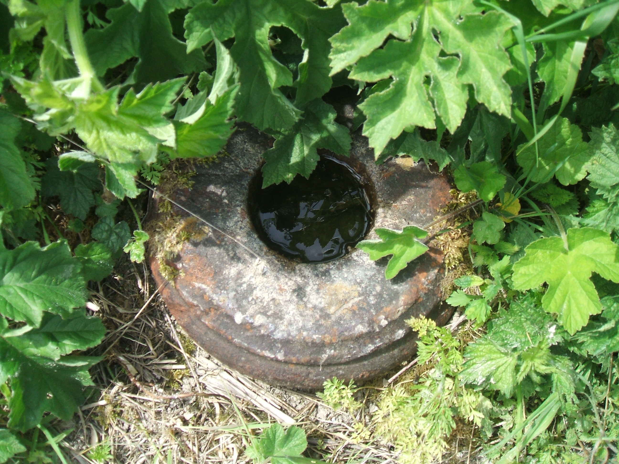
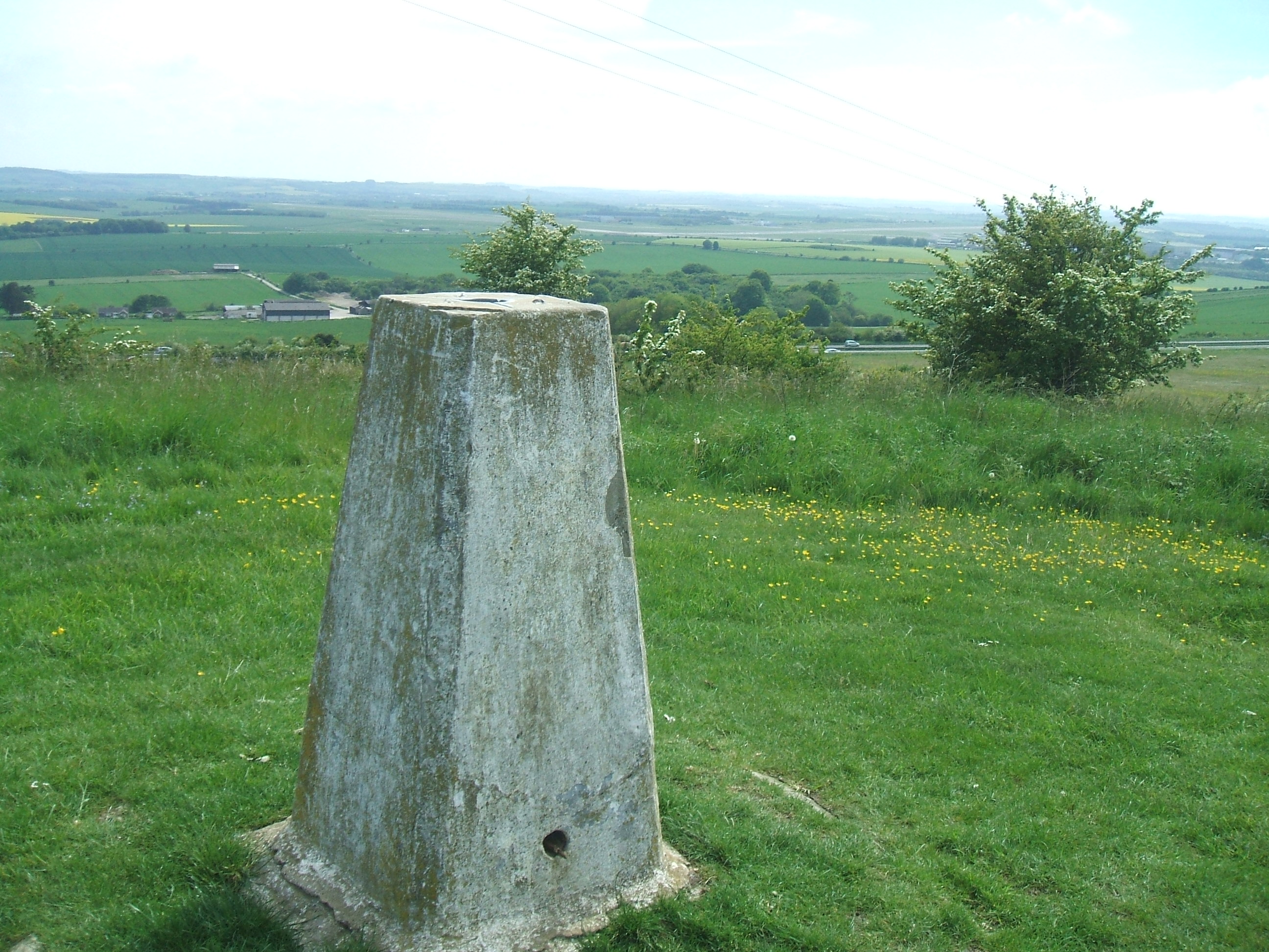
The cannon at the northern end of the baseline, at n51 11.019 w1 43.342, is now hidden under the more modern trigpoint pillar.
http://trigpointing.uk/trig/8928

Your task is to visit both ends of the baseline and answer some questions, to give you the cache's logging password. In keeping with the theme of the cache, some of these involve measuring distances, so YOU WILL NEED TO BRING A TAPE MEASURE.
At the southern end, near Old Sarum (well worth a visit):
- Measure the the maximum height of the nearby "Welcome to Salisbury" sign (from top to bottom of the centre of the sign itself, not from ground level). Let the height, to the nearest odd number of centimetres, be A.
- Find Mudge's cannon. No need to climb the fence, there is an easier route nearby. Measure the full diameter of the cannon (i.e. not just the internal barrel). Let the diameter, to the nearest even number of inches, be B.
At the northern end of the baseline, at the modern trigpoint:
- Let the date on the plaque (month_year) be C. (E.g. May 2021=52021)
- Let the width of the plaque, to the nearest inch, be D.
The password, in figures, is ABCD. (E.g. If the sign height is 85.9 cm, the gun diameter is 24.9 inches, the date is May 2021 and the width of the plaque with the date is 3.7 inches, then the password is "8524520214".)
Note that Amberel's opencache The Other End - OK0243 relates to another cannon, in west London, that was one end of a previous baseline measurement, in1784.
 Dodatkowe waypointy
| Symbol | Typ | Współrzędne | Opis |
|---|---|---|---|

|
Interesujące miejsce | --- | Northern end of baseline. The cannon is hidden under the more modern trigpoint pillar. |
 Obrazki/zdjęcia
 Wpisy do logu:
0x
0x
1x
Wpisy do logu:
0x
0x
1x


