


 Zaloguj się, by zobaczyć współrzędne.
 12x znaleziona
  0x nieznaleziona
  0 komentarze
  0 obserwatorów
  Oceniona jako: znakomita


aby zobaczyć współrzędne oraz
mapę lokalizacji skrzynki
 Atrybuty skrzynki


 Opis
EN
Opis
EN
The North Dartmoor GeoPath incorporates 5 existing opencaches which are still part of the Dartmoor Challenge. This is the 5th and last of those caches and takes you up to the third highest point on Dartmoor, so you will now have reached the top of the highest 3. However, this is very much a hill rather than a tor and has a large cairn on top.
The terrain getting from Taw Head is far better than that encountered getting to it. I would suggest you head up the stream until you get to the waypoint shown and you will then find a path that takes you to the top of Hangingstone Hill. You don't need to go all the way to the top and can branch of left to the cache when suitable to do so.
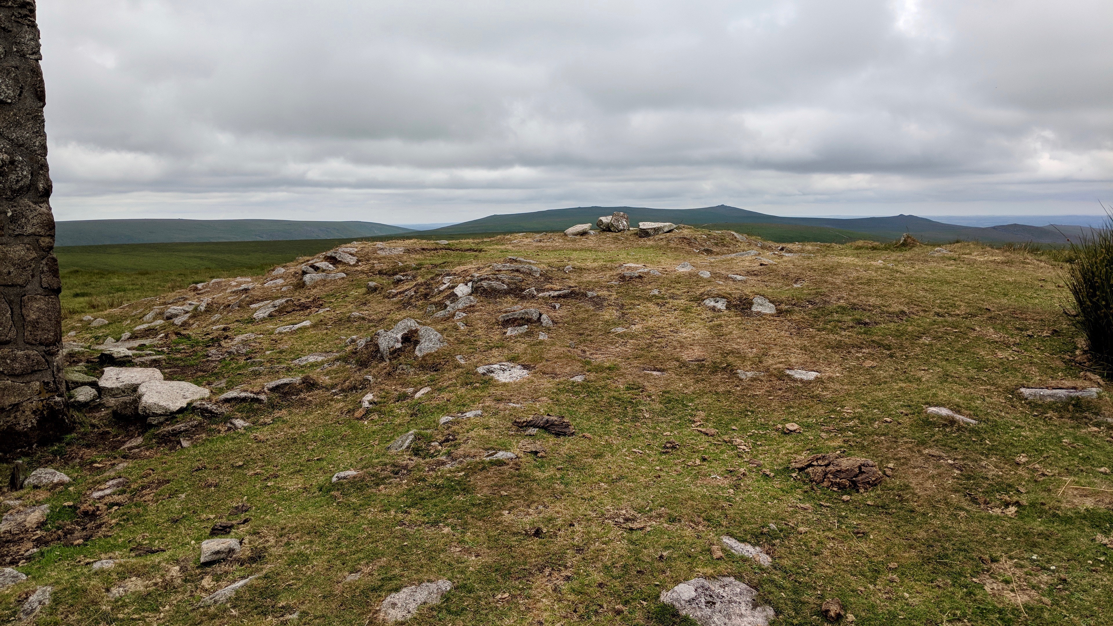
Thanks to Max Piper for this photo of Hangingstone Hill
The Dartmoor Challenge is a series of 42 caches which have been placed in some of the most remote places on either Dartmoor's North Moor or South Moor. Each cache has been placed to bring you to a special place on Dartmoor, often a beautiful stream, a striking tor or another of Dartmoor's endearing features.
21 of the caches are listed on opencaching.org.uk and 21 on geocaching.com. None of the caches are cross-listed and the series could be considered to be 2 separate series.
35 of the caches are traditional caches, 3 are puzzle caches, 2 are moving caches and 2 are 5/5 bonus caches. In order to locate both bonus caches you will need to collect coordinate information which is available in ALL of the 38 feeder caches. Please DO NOT share this bonus information with anybody.
IMPORTANT NOTE: All of the caches on the North Moor are located in or near to one of the Military Ranges where live firing occurs. You must check out the Firing Notices before entering any of the ranges. DO NOT ENTER THE RANGE WHEN THE RED FLAGS ARE FLYING. Never pick up any objects, they may be unexploded devices.
The weather on Dartmoor can change suddenly and unexpectedly and ALL types of weather conditions can be experienced. Please ensure that you have the correct clothing and map & compass (and know how to use them). Please do NOT rely solely on your GPS.
I would like to thank the Dartmoor National Park Authority for their kind permission to place this cache, which has been placed according to the geocaching guidelines.
 Dodatkowe waypointy
| Symbol | Typ | Współrzędne | Opis |
|---|---|---|---|

|
Początek ścieżki | --- | Follow the stream uphill to here and then take the path towards the top of the hill. |
 Dodatkowe informacje
 Obrazki/zdjęcia

 Wpisy do logu:
12x
0x
0x
Wpisy do logu:
12x
0x
0x


